Every day, 6.30 am to 10 pm · 7 place des Ormeaux, Tourtour

La Farigoulette Tourtour

Haut-Var guide · around Tourtour Explore the map of the guide

17 places

  • Tourtour

    Village · Tourtour · You are here

    The hilltop village at the centre of this guide: lanes, fountains and views reaching to the sea.

  • Villecroze

    Village · Villecroze · ≈ 12 min · 5 km

    Our neighbouring village, below a cliff hollowed with caves, with a large shaded park.

  • Aups

    Village · Aups · ≈ 20 min · 11 km

    The lively market town of the Haut-Var, and its famous winter truffle market.

  • Salernes

    Village · Salernes · ≈ 22 min · 12 km

    The home of the Provençal terracotta tile, with a museum devoted to ceramics.

  • Cotignac

    Village · Cotignac · ≈ 40 min · 25 km

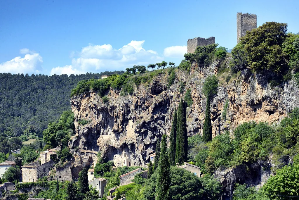
    A village set against a tufa cliff riddled with cave dwellings.

  • Cascade de Sillans

    Nature · Sillans-la-Cascade · ≈ 30 min · 18 km

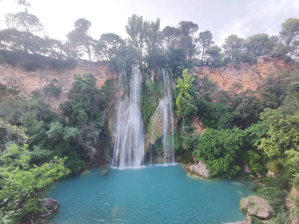
    A waterfall dropping more than forty metres into a green gorge, seen from a viewpoint.

  • Lac de Sainte-Croix — plage de Bauduen

    Nature · Bauduen · ≈ 40 min · 29 km

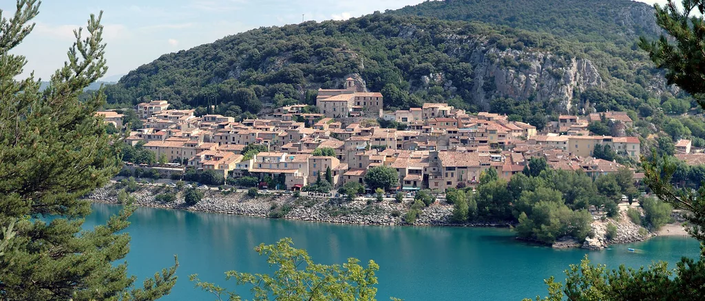
    The Verdon’s great turquoise lake, from the small village of Bauduen and its beach.

  • Pont du Galetas — Gorges du Verdon

    Nature · Aiguines · ≈ 50 min · 37 km

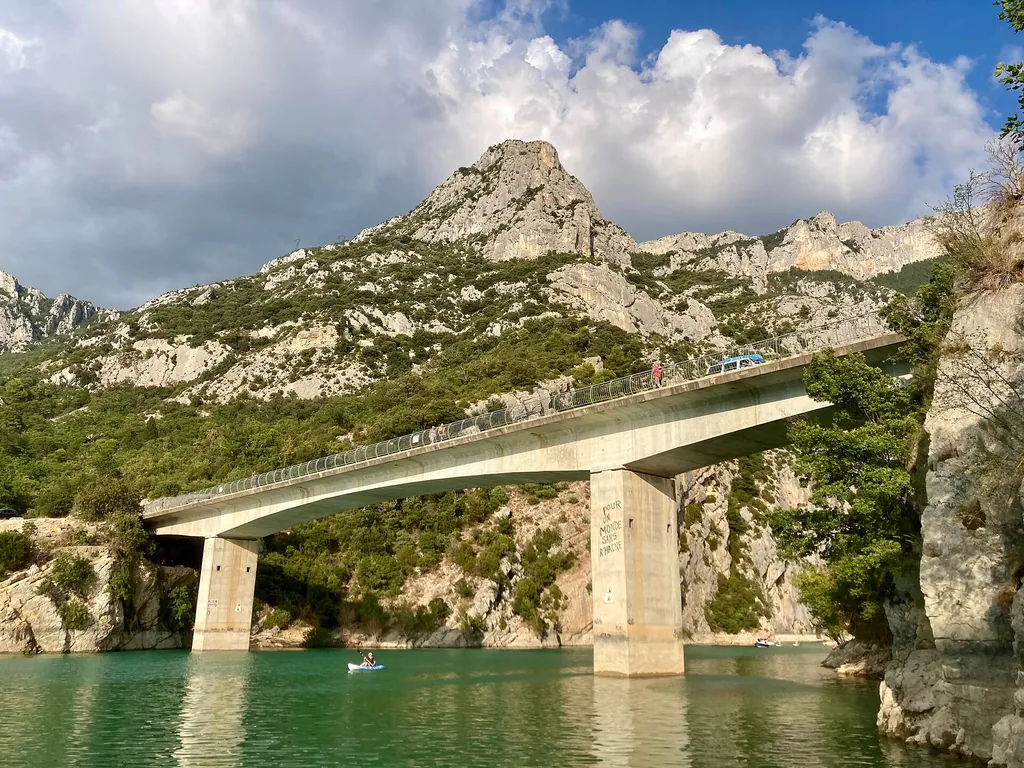
    Where the Verdon leaves its gorge and flows into the lake: the closest gateway to the gorges.

  • Église Saint-Denis et sa table d’orientation

    Heritage · Tourtour · On foot · 300 m

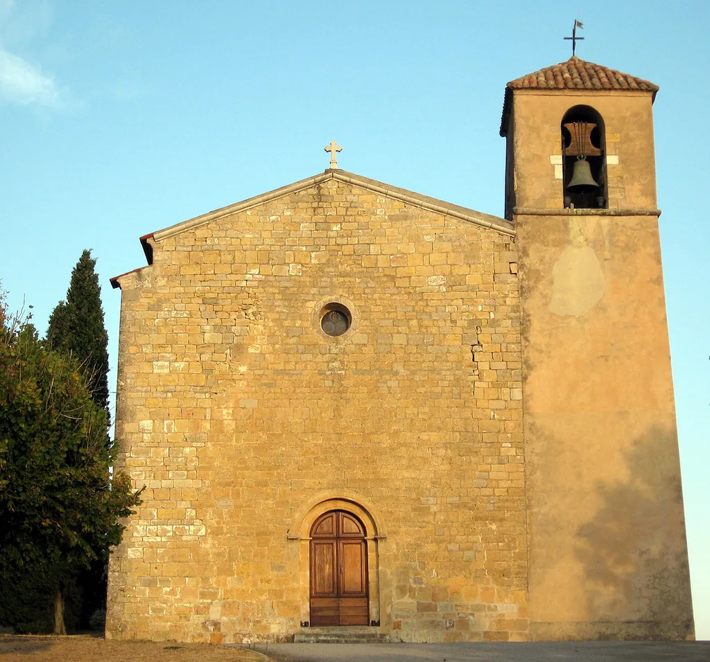
    The village’s Romanesque church and, right beside it, one of the widest views in the Haut-Var.

  • Moulin à huile de Tourtour

    Heritage · Tourtour · On foot · 100 m

    The village oil mill, its water wheel, and art exhibitions in summer.

  • Tour de Grimaldi

    Heritage · Tourtour · ≈ 5 min · 2 km, or on foot (3.4 km loop)

    A lone medieval tower on the ridge, at the end of an easy, pleasant walk.

  • Parc et grottes troglodytiques de Villecroze

    Heritage · Villecroze · ≈ 12 min · 5 km

    Fortified rooms carved into the cliff, above a park and a waterfall.

  • Terra Rossa — Maison de la céramique architecturale

    Heritage · Salernes · ≈ 22 min · 12 km

    The museum of Salernes terracotta tiles and ceramics.

  • Habitats troglodytes du rocher de Cotignac

    Heritage · Cotignac · ≈ 40 min · 25 km

    A short walk through the old dwellings carved into the cliff.

  • Sanctuaire Notre-Dame de Grâces

    Heritage · Cotignac · ≈ 40 min · 27 km

    A Marian sanctuary on a wooded hill, a few minutes from Cotignac.

  • Abbaye du Thoronet

    Heritage · Le Thoronet · ≈ 45 min · 29 km

    One of the great Cistercian abbeys of Provence, strikingly austere.

  • Marché aux truffes noires d’Aups

    Local produce · Aups · ≈ 20 min · 11 km

    The Haut-Var’s winter black truffle market, every Thursday morning.

Interactive map: drag to move, Ctrl + scroll to zoom.

The Haut-Var around Tourtour in 17 places: hilltop villages, viewpoints, waterfalls and quiet discoveries, from Villecroze to Lac de Sainte-Croix. A deliberately short selection, the one we recommend to our guests, checked against official sources. Opening hours, access and bathing rules change with the seasons, so please follow the official links before you set off.

01

Villages with character

● Village

Village
Tourtour
From Tourtour
You are here
Time to allow
Half a day
Access
Pedestrian centre; park on the edge of the village.
Address or access point
Place des Ormeaux, 83690 Tourtour
Hours and prices
Provençal market on Wednesday and Saturday mornings at the boulodrome (Tourtour town hall); off-season running to be confirmed.
Coordinates
43.58917, 6.30267

Tourtour

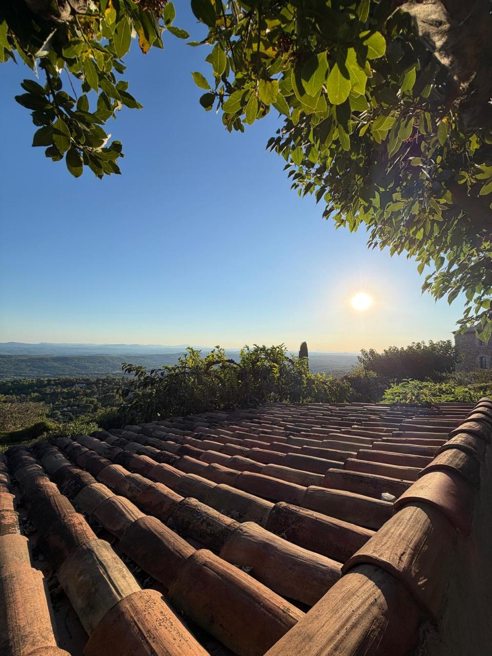
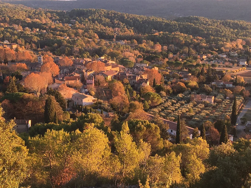
The old tiled rooftops of Tourtour and the Haut-Var horizon in the sun, framed by leaves
Photo: La Farigoulette

Perched at around 637 m and listed among the Most Beautiful Villages of France, Tourtour is best explored on foot, without a map. Three successive ramparts, eight fountains, narrow cobbled lanes and, on the square, two bronzes by Bernard Buffet — the village has long drawn artists.

Allow a morning to see it all, walking down to the olive mill and back up to Saint-Denis church. Our page on the village describes its heritage in more detail.

Best early in the morning, when low light skims the façades and the square wakes up.
Sources checked
↑ Back to the map

● Village

Village
Villecroze
From Tourtour
≈ 12 min · 5 km
Time to allow
One to two hours
Access
Public village; free car park at Pré de Fine, next to the park.
Address or access point
Place du Général de Gaulle, 83690 Villecroze
Hours and prices
Provençal market on Thursday mornings (Villecroze town hall).
Coordinates
43.58286, 6.27614

Villecroze

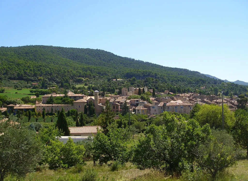
Villecroze seen from above, its rooftops surrounded by olive trees and woods in autumn light
Photo: Phjarry83 · CC BY-SA 4.0, Wikimedia Commons

Villecroze stretches out below a tufa cliff, just beneath Tourtour. You get there in a few minutes along a winding road with lovely glimpses of the plain.

The village centre and its park are easy going, which makes it a good stop with children or on a hot day. The fortified caves above the park have their own entry below.

Sources checked
↑ Back to the map

● Village

Village
Aups
From Tourtour
≈ 20 min · 11 km
Time to allow
One to two hours
Access
Public village; intercommunal tourist office at 242 avenue Albert-Ier.
Address or access point
Place Frédéric-Mistral, 83630 Aups
Hours and prices
Provençal market on Wednesdays and Saturdays, 8 am – 1 pm, Place Frédéric-Mistral (cancelled in bad weather, according to the tourist office).
Coordinates
43.62716, 6.22373

Aups

The village of Aups and its bell tower at the foot of wooded hills
Photo: Perditax · CC0, Wikimedia Commons

Aups is the small capital of the Haut-Var: a busy town with plane-tree-lined avenues, fountains and shops. It is also the gateway to Lac de Sainte-Croix, about twenty minutes to the north.

Market mornings, on Wednesdays and Saturdays, are the nicest time to stop. From late November to March, Thursday mornings belong to the black truffle (see its own entry).

Sources checked
↑ Back to the map

● Village

Village
Salernes
From Tourtour
≈ 22 min · 12 km
Time to allow
One to two hours
Access
Public village; tourist information point on Cours Théodore-Bouge.
Address or access point
Cours Théodore-Bouge, 83690 Salernes
Hours and prices
Provençal market on Wednesday mornings on Cours Théodore-Bouge; a Sunday morning market is also listed, season to be checked with the town.
Coordinates
43.56353, 6.23339

Salernes

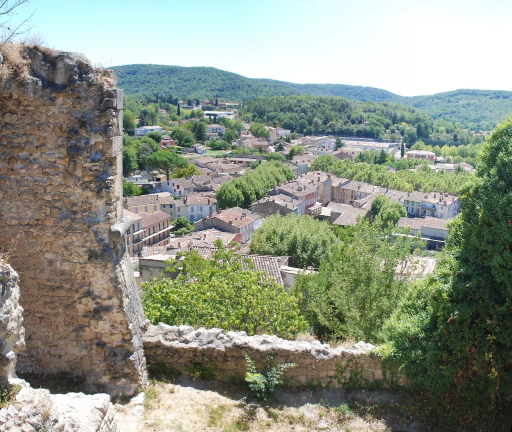
The rooftops of Salernes seen from the castle ruins
Photo: Lantus · CC BY-SA 3.0, Wikimedia Commons

Salernes owes its reputation to clay: for centuries its workshops made the hexagonal terracotta tiles that cover floors all over Provence. The village keeps that identity, with its ceramicists and the Terra Rossa museum.

The shady main avenue is a pleasant stop during the Wednesday morning market, before heading on to Sillans or Cotignac.

Sources checked
↑ Back to the map

● Village

Village
Cotignac
From Tourtour
≈ 40 min · 25 km
Time to allow
Half a day
Access
Public village; visits start from Place de la Mairie.
Address or access point
Place de la Mairie, 83570 Cotignac
Hours and prices
Market on Tuesdays, 8 am – 1 pm, Cours Gambetta and Place Joseph-Sigaud (Provence Verte & Verdon tourist office).
Coordinates
43.52903, 6.14902

Cotignac

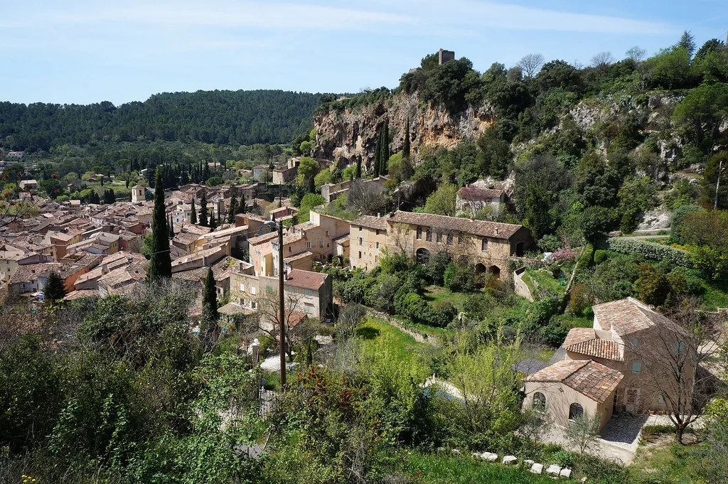
The houses of Cotignac at the foot of the tufa cliff
Photo: Paolo Schubert · CC BY-SA 3.0, Wikimedia Commons

Cotignac nestles beneath a tall tufa cliff, hollowed with old cave dwellings that can be visited in season. Below, the plane-tree avenue and its café terraces give the village a gentle Provençal charm.

It is the furthest stop in this guide, and pairs well with the nearby Notre-Dame de Grâces sanctuary or with Le Thoronet Abbey.

Sources checked
↑ Back to the map

02

Nature and viewpoints

● Nature

Village
Sillans-la-Cascade
From Tourtour
≈ 30 min · 18 km
Time to allow
About an hour on foot
Access
A protected natural area managed by the Var département. Access to the pool and bathing are forbidden (falling rocks). Stay on marked paths, keep dogs on a lead and wear sturdy shoes; not suitable for pushchairs or reduced mobility. In summer, check the fire-risk map before setting off.
Address or access point
Place du 8-Mai-1945 car park, 83690 Sillans-la-Cascade (paid from April to September)
Hours and prices
Open all year according to the tourist office (occasional closures by municipal order). Paid parking from 1 April to 30 September, 9 am – 7 pm: first 30 minutes free, then €1 per quarter of an hour (checked 3 November 2026).
Coordinates
43.56809, 6.18177

Cascade de Sillans

The Sillans waterfall dropping into its turquoise pool
Photo: Harald Hetzner · CC0, Wikimedia Commons

Just outside the village of Sillans, a woodland path leads to the viewpoint over the waterfall and its strikingly turquoise pool. The Var département has recently redeveloped the site with a new path and viewing platform.

Bathing is forbidden and the pool is closed off: the waterfall is admired from above. Come early in the morning in summer, or out of season, to enjoy it in peace.

The coolest spot around on a hot day, as long as you stay on the paths.

Sources checked
↑ Back to the map

● Nature

Village
Bauduen
From Tourtour
≈ 40 min · 29 km
Time to allow
Half a day
Access
Free public beach; free car park at the village entrance. No animals on the beach. Lifeguards in July and August, 11 am – 6 pm.
Address or access point
Rue des Jardins / La Jetée, 83630 Bauduen
Coordinates
43.73204, 6.17712

Lac de Sainte-Croix — plage de Bauduen

The village of Bauduen on the turquoise shore of Lac de Sainte-Croix
Photo: Calips · CC BY-SA 3.0, Wikimedia Commons

Bauduen is one of the few villages built right on the shore of Lac de Sainte-Croix. Its beach, below the houses, lets you enjoy the water without joining the busiest Verdon tourist roads.

The drive from Tourtour goes through Aups and crosses lovely oak-covered hills. In summer, arrive early: parking near the village fills up quickly.

Sources checked
↑ Back to the map

● Nature

Village
Aiguines
From Tourtour
≈ 50 min · 37 km
Time to allow
One to two hours
Access
Road bridge on the D957, open access all year; free car parks nearby. Very busy in summer.
Address or access point
D957, Pont du Galetas, 83630 Aiguines
Coordinates
43.80167, 6.24944

Pont du Galetas — Gorges du Verdon

The Galetas bridge over the Verdon, where the gorge opens out
Photo: kallerna · CC BY-SA 4.0, Wikimedia Commons

At Pont du Galetas, the Verdon leaves the narrow canyon of its gorge and opens onto Lac de Sainte-Croix. Sheer cliffs on one side, turquoise lake water on the other: it is the easiest way to glimpse the Verdon Gorge from Tourtour.

In summer it is very busy; in spring and autumn it is calm, with beautiful light late in the day.

Sources checked
↑ Back to the map

03

Heritage and culture

● Heritage

Village
Tourtour
From Tourtour
On foot · 300 m
Time to allow
Thirty minutes
Access
Free entry; the church is closed during weddings, baptisms, funerals and the Christmas Pastorale. Public viewpoint beside the church.
Address or access point
Saint-Denis church, 83690 Tourtour
Coordinates
43.58813, 6.30462

Église Saint-Denis et sa table d’orientation

The stone façade and bell tower of the Saint-Denis church in Tourtour
Photo: MartinPutz · CC BY-SA 3.0, Wikimedia Commons

Slightly away from the centre, on high ground, the Romanesque church of Saint-Denis watches over the village. The short path up from the square already offers fine views.

Beside the church, a viewing table helps you read the landscape: on a clear day the view stretches across the Var hills towards the coast.

Best late in the day, before walking back down to dinner on the square.

Sources checked
↑ Back to the map

● Heritage

Village
Tourtour
From Tourtour
On foot · 100 m
Time to allow
Twenty minutes
Access
Free entry during opening periods.
Address or access point
10 rue des Moulins, 83690 Tourtour
Hours and prices
Open from 1 June to 30 September 2026, with art exhibitions; traditional pressing in December and January (tourist office, checked 3 November 2026).
Coordinates
43.58987, 6.30130

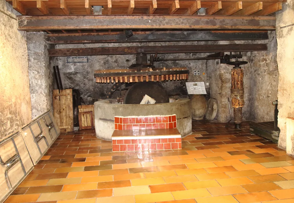
Moulin à huile de Tourtour

Inside the Tourtour oil mill: the stone millstone and wooden gears
Photo: Rémi Jouan · CC BY-SA 4.0, Wikimedia Commons

A stone’s throw from Place des Ormeaux, the village mill recalls the Haut-Var’s olive-growing past. Its water wheel and the tools of an oil mill can still be seen.

In summer it hosts art exhibitions; in winter, traditional olive pressing brings the place back to life.

Sources checked
↑ Back to the map

● Heritage

Village
Tourtour
From Tourtour
≈ 5 min · 2 km, or on foot (3.4 km loop)
Time to allow
About an hour on foot
Access
Open access all year, outdoors. Easy 3.4 km walking loop from Place de la Trinité.
Address or access point
Tour de Grimaldi, 83690 Tourtour
Coordinates
43.59856, 6.29091

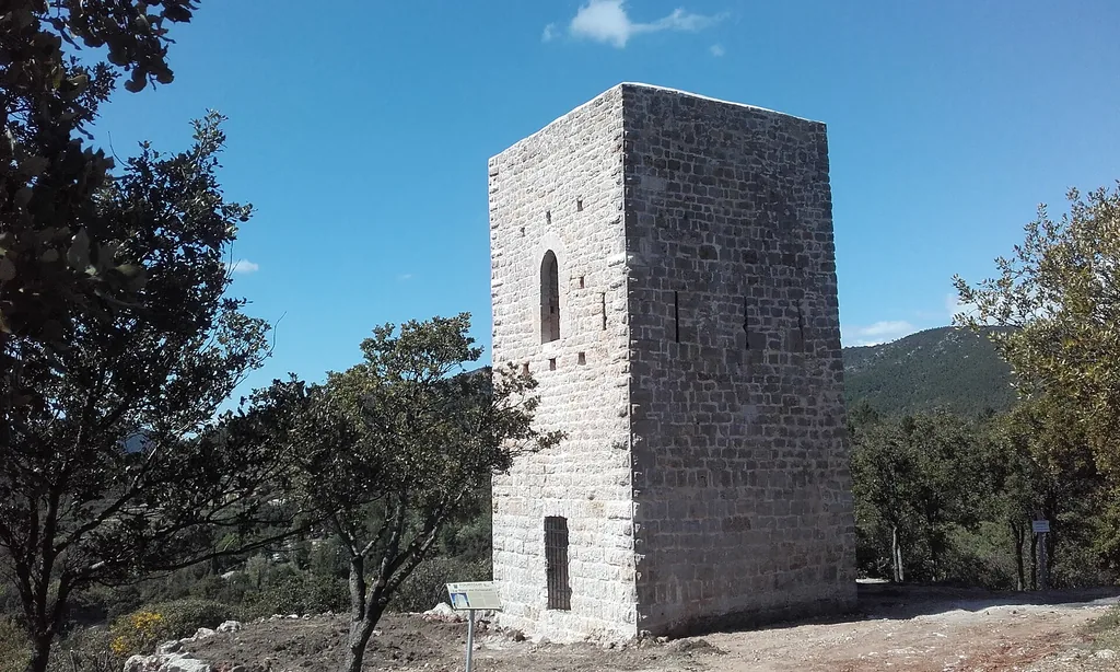
Tour de Grimaldi

The Grimaldi tower, a square stone tower among holm oaks
Photo: René Dinkel · CC BY-SA 4.0, Wikimedia Commons

A medieval reminder of Tourtour’s seigneurial past, the Grimaldi tower stands alone on the ridge north-west of the village. It was restored after being struck by lightning.

The nicest way there is on foot, along a 3.4 km waymarked loop from Place de la Trinité: an easy hour’s walk with wide views over the countryside.

Sources checked
↑ Back to the map

● Heritage

Village
Villecroze
From Tourtour
≈ 12 min · 5 km
Time to allow
One hour
Access
Free park, open all year. Caves in season only, booked online; not allowed for under-6s, baby carriers or animals; closed shoes required; not accessible for reduced mobility.
Address or access point
Parc des Grottes, 83690 Villecroze (Pré de Fine car park)
Hours and prices
Caves open from 1 April to 30 October 2026; the 2026 season is over, check the official website for 2027 dates.
Coordinates
43.58544, 6.27752

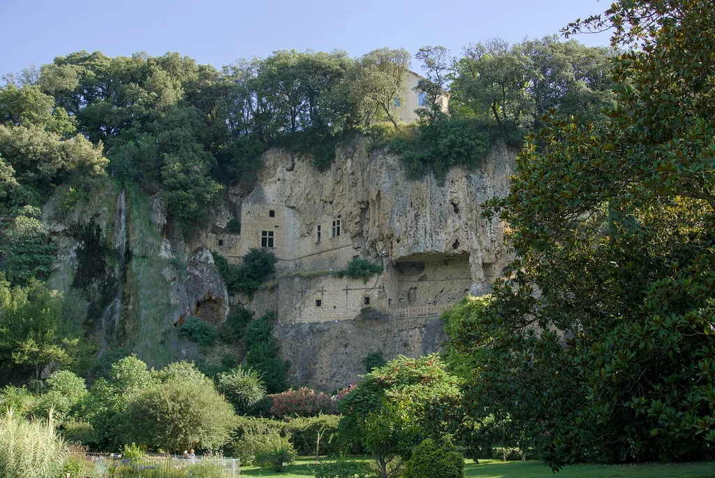
Parc et grottes troglodytiques de Villecroze

The Villecroze cliff with its walled-in cave dwellings above the park
Photo: Polibil · CC BY-SA 4.0, Wikimedia Commons

Above Villecroze park, the tufa cliff shelters caves that were fitted out and fortified over the centuries. In season, visitors climb a stairway cut into the rock to rooms opening onto the void.

The park itself is open all year: pools, a waterfall and tall trees make it a favourite cool spot.

Sources checked
↑ Back to the map

● Heritage

Village
Salernes
From Tourtour
≈ 22 min · 12 km
Time to allow
One hour
Access
Museum in the Les Launes district.
Address or access point
Quartier Les Launes, 83690 Salernes
Hours and prices
2026 season: 2 May to 31 October, Tuesday to Saturday, 9.30 am – 12.30 pm and 2.30 – 5.30 pm. Full price €7, reduced €5, free under 12 (official website, checked 3 November 2026). Closed in winter; 2027 dates not yet published.
Coordinates
43.55984, 6.23337

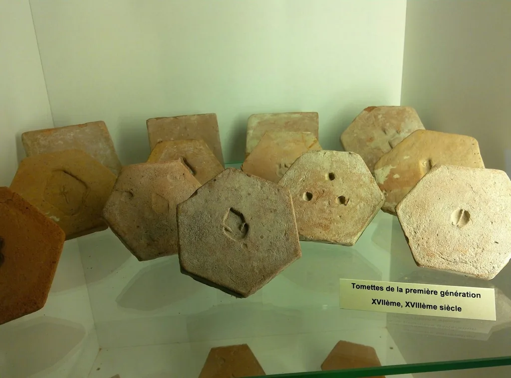
Terra Rossa — Maison de la céramique architecturale

Old hexagonal floor tiles displayed at the Terra Rossa ceramics museum
Photo: Lantus · CC BY-SA 3.0, Wikimedia Commons

Based in Salernes, Terra Rossa tells the story of the architectural ceramics that made the village famous: terracotta tiles, glazed tiles and the know-how of the local works.

An hour’s visit that rounds off a walk through the village and its workshops.

Sources checked
↑ Back to the map

● Heritage

Village
Cotignac
From Tourtour
≈ 40 min · 25 km
Time to allow
15 to 30 minutes
Access
Reached by steps from Place de la Mairie (about 90 steps, with narrow, steep passages). Not advised for those prone to vertigo; unsuitable for pushchairs or reduced mobility; closed in rain.
Address or access point
Start at Place de la Mairie, 83570 Cotignac
Hours and prices
Seasonal opening; check times with the tourist office. Entry €2.50, free under 10 (tourist office, checked 3 November 2026).
Coordinates
43.52971, 6.14884

Habitats troglodytes du rocher de Cotignac

The Cotignac rock face hollowed with caves, topped by the old castle towers
Photo: Pierre Bona · CC BY-SA 3.0, Wikimedia Commons

Above the rooftops of Cotignac, the tufa cliff is riddled with cavities that were once lived in. A signposted route, up steps and through narrow passages, lets you explore them and look down over the village.

The visit is short but spectacular; it needs dry weather and a steady foot.

Sources checked
↑ Back to the map

● Heritage

Village
Cotignac
From Tourtour
≈ 40 min · 27 km
Time to allow
Thirty minutes to an hour
Access
Free entry; an active place of pilgrimage, please respect services. No dogs in the church. From June to September, access depends on forest fire restrictions. The sanctuary reported car park closures in autumn 2026: check its website.
Address or access point
Notre-Dame de Grâces sanctuary, 83570 Cotignac
Hours and prices
Church open 7 am – 7 pm all year, until 8 pm from 1 May to 1 October (tourist office, checked 3 November 2026).
Coordinates
43.52035, 6.14679

Sanctuaire Notre-Dame de Grâces

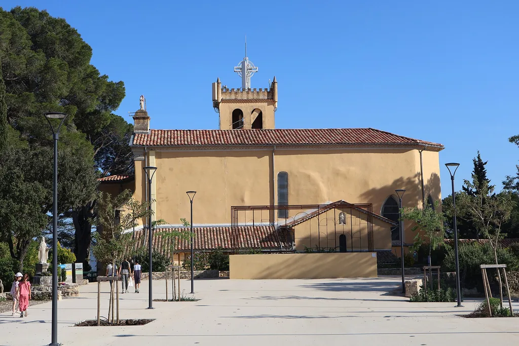
The Notre-Dame-de-Grâces sanctuary and its forecourt in Cotignac
Photo: FredSeiller · CC0, Wikimedia Commons

On a wooded hill south of Cotignac, Notre-Dame de Grâces is a place of pilgrimage that still draws many visitors. The site enjoys a fine view over the valley and is very peaceful outside services.

It pairs naturally with a visit to the village of Cotignac, four minutes away by car.

Sources checked
↑ Back to the map

● Heritage

Village
Le Thoronet
From Tourtour
≈ 45 min · 29 km
Time to allow
One to two hours
Access
National monument (Centre des monuments nationaux), on-site parking. No dogs except guide and assistance dogs.
Address or access point
RD 79, 83340 Le Thoronet
Hours and prices
1 April to 30 September, 10 am – 6.30 pm; 1 October to 31 March, 10 am – 1 pm and 2 – 5 pm (last entry 45 minutes before closing). Full price €9, free under 18 and, under conditions, for EU 18–25-year-olds (official website, checked 3 November 2026). Exceptional closures listed on the website.
Coordinates
43.46055, 6.26366

Abbaye du Thoronet

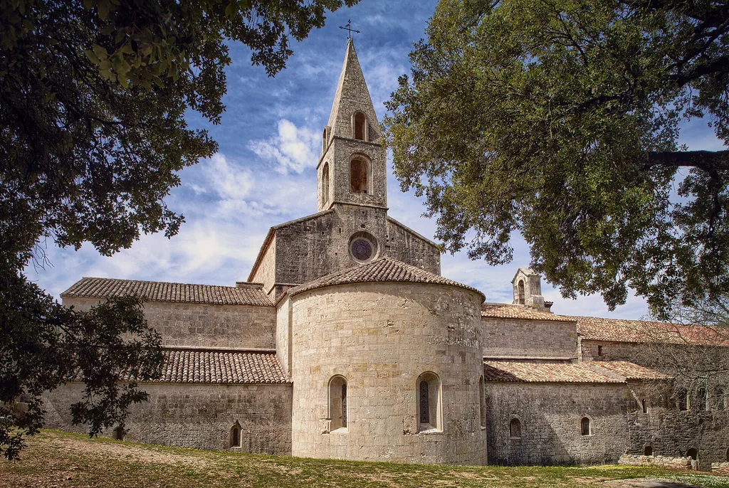
The abbey church of Le Thoronet and its bell tower, seen from the south between oaks
Photo: Rolf Kranz · CC BY-SA 4.0, Wikimedia Commons

Hidden in a wooded valley, Le Thoronet is one of the three great Cistercian abbeys of Provence. Bare stone, light, proportion: everything is pared back, which is what makes it so moving.

It is the finest heritage visit in the area in winter, when the village museums are closed. Allow about 45 minutes’ drive from Tourtour.

Sources checked
↑ Back to the map

04

Markets and local produce

● Local produce

Village
Aups
From Tourtour
≈ 20 min · 11 km
Time to allow
A morning
Access
Open-air market, free entry, Place Frédéric-Mistral. Sales run by the Var truffle growers’ association; cash only. May close early once the truffles are sold.
Address or access point
Place Frédéric-Mistral, 83630 Aups
Hours and prices
Thursdays, 9 am – 12 noon, from 19 November 2026 to March 2027 depending on the harvest (tourist office, checked 3 November 2026).
Coordinates
43.62716, 6.22373

Marché aux truffes noires d’Aups

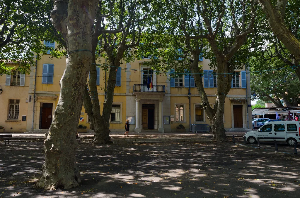
Place Frédéric-Mistral in Aups, where the market is held, shaded by plane trees in front of the town hall
Photo: holadeejay · CC BY-SA 3.0, Wikimedia Commons

From late November until spring, the square in Aups hosts the Var truffle growers every Thursday morning. You come to smell, choose and buy black truffles — “rabasse” in Provençal — straight from the producers.

Arrive at opening time: in a lean season the stalls empty quickly.

Sources checked
↑ Back to the map

Weekly markets

The Provençal markets of the villages in this guide, according to the town halls and tourist offices. They are cancelled in bad weather; some are seasonal.

DayWhereTime
TuesdayCotignac8 am – 1 pm
WednesdayTourtourmorning
WednesdayAups8 am – 1 pm
WednesdaySalernesmorning
ThursdayVillecrozemorning
Thursday (late Nov – March)Aups — truffles9 am – 12 noon
SaturdayTourtourmorning
SaturdayAups8 am – 1 pm
SundaySalernesmorning, season to be checked

Day plans

Three ways to spend the day

I

Half a day around Tourtour

Mostly on foot, about 25 minutes’ driving in all.

  1. The villageFrom Place des Ormeaux to the olive mill, then up to Saint-Denis church and its viewing table. Read more
  2. The Grimaldi towerAn easy 3.4 km loop, about an hour. Read more
  3. VillecrozeTen minutes’ drive to the park and, from April to October, the caves (book online). Read more
  4. Back to TourtourIn time for an aperitif facing the view.
II

A day of villages and heritage

Ideal on a Tuesday from May to October; about two hours’ driving.

  1. CotignacThe Tuesday market, then the cave dwellings in season. Read more
  2. Notre-Dame de GrâcesFour minutes from the village. Read more
  3. Sillans waterfallThe viewpoint, about twelve minutes away. No bathing. Read more
  4. SalernesTerra Rossa museum in the afternoon, then back via Villecroze. Read more
  5. In winterSwap Salernes for Le Thoronet Abbey, twenty minutes from Cotignac. Read more
III

A nature day towards the Verdon

About two hours’ driving, via Aups.

  1. AupsThe market on Wednesday or Saturday; truffles on Thursdays in winter. Read more
  2. Lac de Sainte-CroixBauduen beach, about twenty minutes on. Read more
  3. Pont du GaletasVia Les Salles-sur-Verdon: the mouth of the gorge. Read more
  4. BackAbout fifty minutes back to Tourtour.

After your walk

End the day at La Farigoulette

After exploring Tourtour and its surroundings, round off your trip on our terrace overlooking the Haut-Var, on Place des Ormeaux. Open every day from 6.30 am to 10 pm.

Information checked on 3 November 2026. Opening hours, prices and access conditions may change: please refer to the official websites listed for each place.